Flood-stricken residents in Far North Queensland are being warned to expect further heavy rain from a monsoon trough in the coming hours.
The warning was issued by the Bureau of Meteorology as parts of the regions continue to recover after devastating flooding caused by ex-Tropical Cyclone Jasper.
A monsoon trough developing off the Gulf of Carpentaria is expected to bring more heavy rainfall and flooding to those regions.
READ MORE: Riots in Papua New Guinea's two biggest cities reportedly leave 16 dead
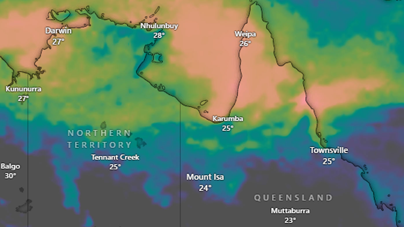
Forecasters are warning of rainfall totals from 50mm to 150mm across parts of the far north tropical coast from today.
The monsoon has a 25 per cent chance of strengthening into a Tropical Cyclone, but that depends on the movement of another system forming west of Darwin.
That tropical low will likely bring widespread heavy rainfall to the Top End or Western Australia's Kimberley region into the weekend.
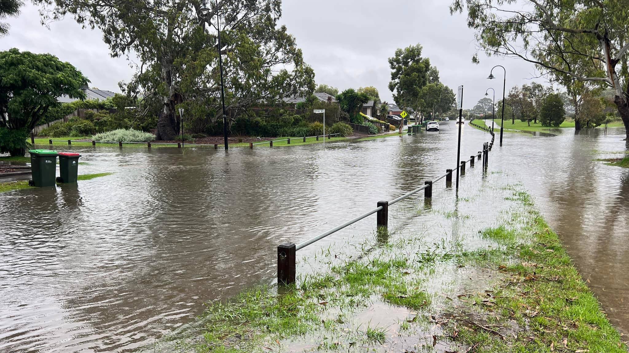
https://twitter.com/BOM_Qld/status/1745324741848637505?ref_src=twsrc%5EtfwMeanwhile, parts of northern Victoria are being warned of further flooding from today.
Despite rainfall and floodwaters receding, authorities said dozens of homes in the state's north still remained at risk.
VicEmergency issued a watch and act warning for the town of Shepparton where the Goulburn River level is expected to rise.
The Goulburn River at McCoys Bridge may exceed the minor flood level of nine metres tomorrow.
READ MORE: First Asian nation to legalise cannabis now making dramatic backflip
On the other side of the country, Western Australia has been put on a heatwave alert this weekend, with the hottest areas of the state forecast to hit temperatures in the 40s.
In the state's north-east, the town of Marble Bar – traditionally the hottest in WA – is expected to reach a scorching 46 degrees on Saturday and Sunday
Source: https://ift.tt/ronwe8U
Comments
Post a Comment