Three states are facing damaging winds and forecast thunderstorms today as a deepening low and cold front move eastward across Australia.
South Australia, Victoria and New South Wales are all once again under the gun, with South Australia recording close to 100,000 lightning strikes overnight.
Weatherzone reported another thunderstorm outbreak was expected today in the east.
READ MROE: Australian who saw friend crushed to death slams Seoul authorities
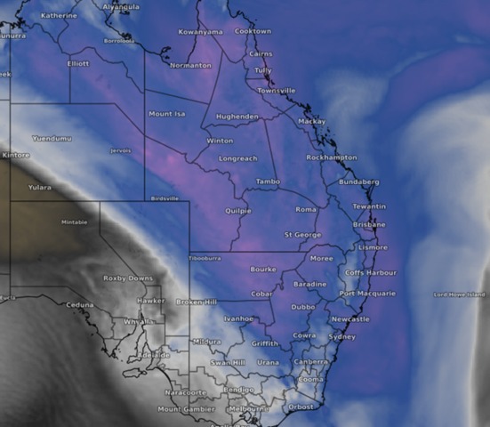
Western NSW and northern Victoria are set to get the worst of the weather this morning, before the storms spread into Queensland.
There is a potential for flash flooding, large hail and damaging winds of more than 90km/hr.
Gusts of over 100km/hr were recorded yesterday, with 102km/hr winds sweeping through the outback town of Coober Pedy.
READ MORE: Children among at least 60 dead after India bridge collapse
By Tuesday morning, the weather system causing the damage will be crossing the Queensland coast and out of NSW.
But there is more unusual weather to come through the week.
Weatherzone said the frigid air behind the cold front would bring winter temperatures back to south-east Australia for some days.
Multiple weather and flood warnings remain in place across NSW and Victoria.
Source: https://ift.tt/MPQsoqC
Comments
Post a Comment