A young boy has been injured by a falling tree branch in Sydney's north-west as dangerous winds lashed the city, with weather authorities warning there's more to come.
A severe weather warning remains in place over the Hunter and Illawarra regions in New South Wales.
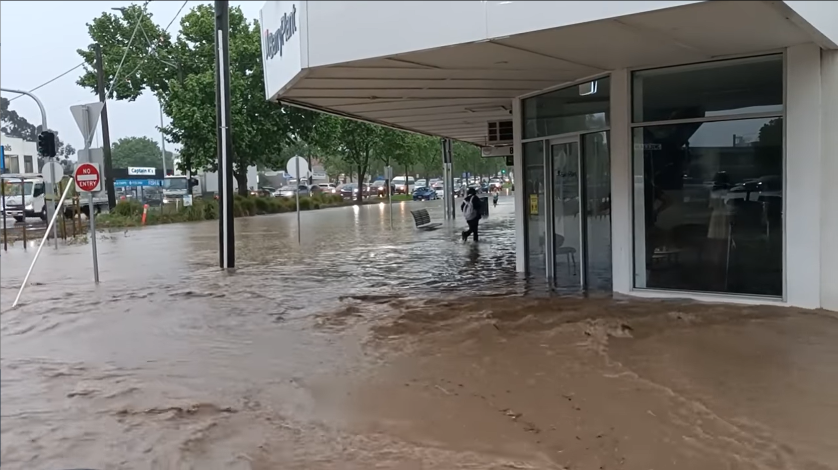
There were a number of flood rescues south of Sydney after an intense storm passed through Yass and the surrounding regions.
READ MORE: Trump Organisation faces criminal tax fraud trial over perks
A massive cold front moving across the south-east is also expected to see temperatures drop up to eight degrees between now and Wednesday in Sydney's west.
In Melbourne, it's forecast to be just 14C, with rain, storms and even possible hail forecast - the coldest Cup Day since 1995, according to the Bureau of Meteorology.
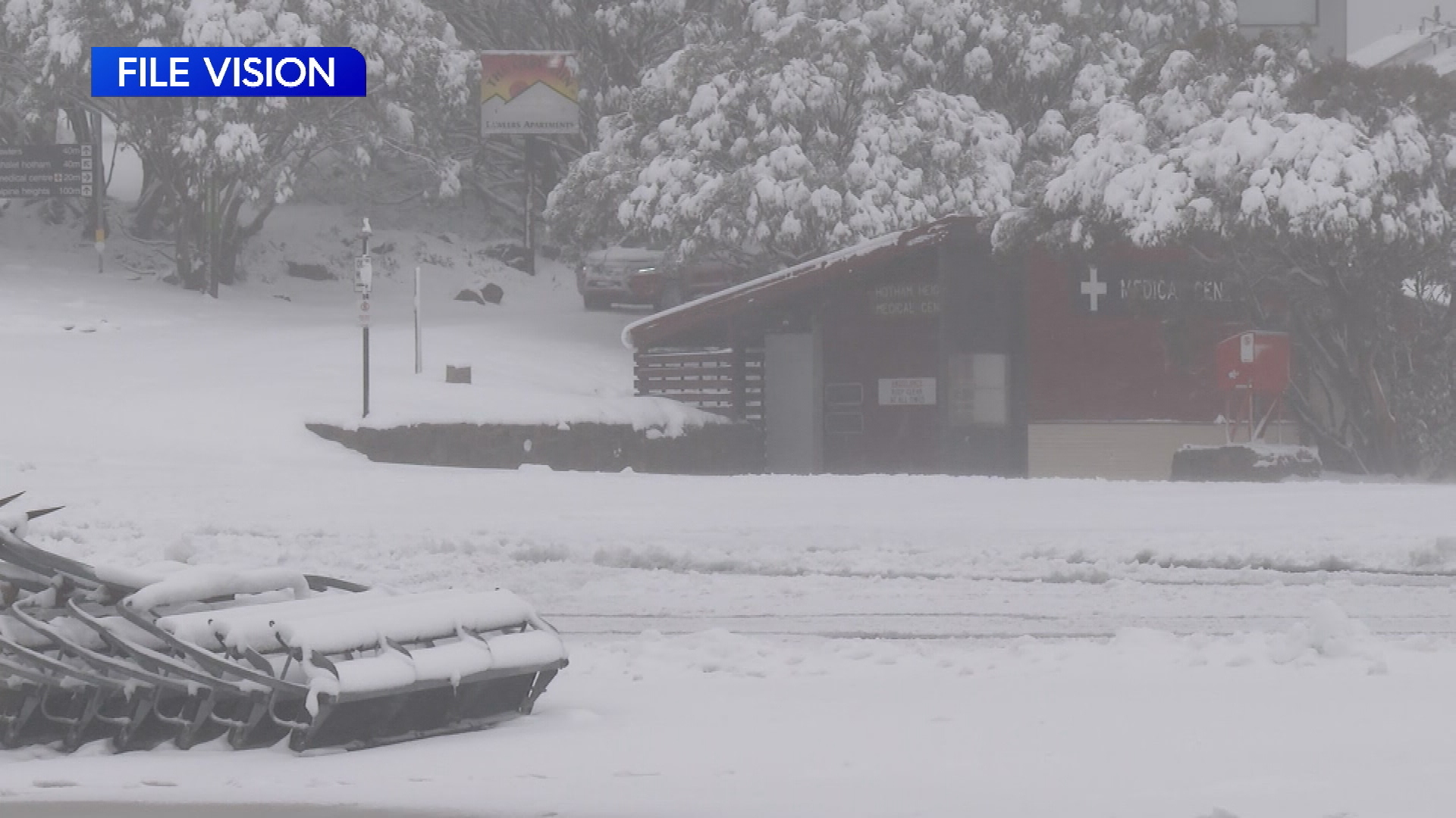
The cold temperatures, widespread showers, and Alpine snow are forecast until mid-week, all of which are unseasonal for November.
READ MORE: Just 137 Seoul police assigned to crowd of 100,000
Today, cold, wet, and windy weather will spread across much of South Australia, Victoria, Tasmania, and southern NSW.
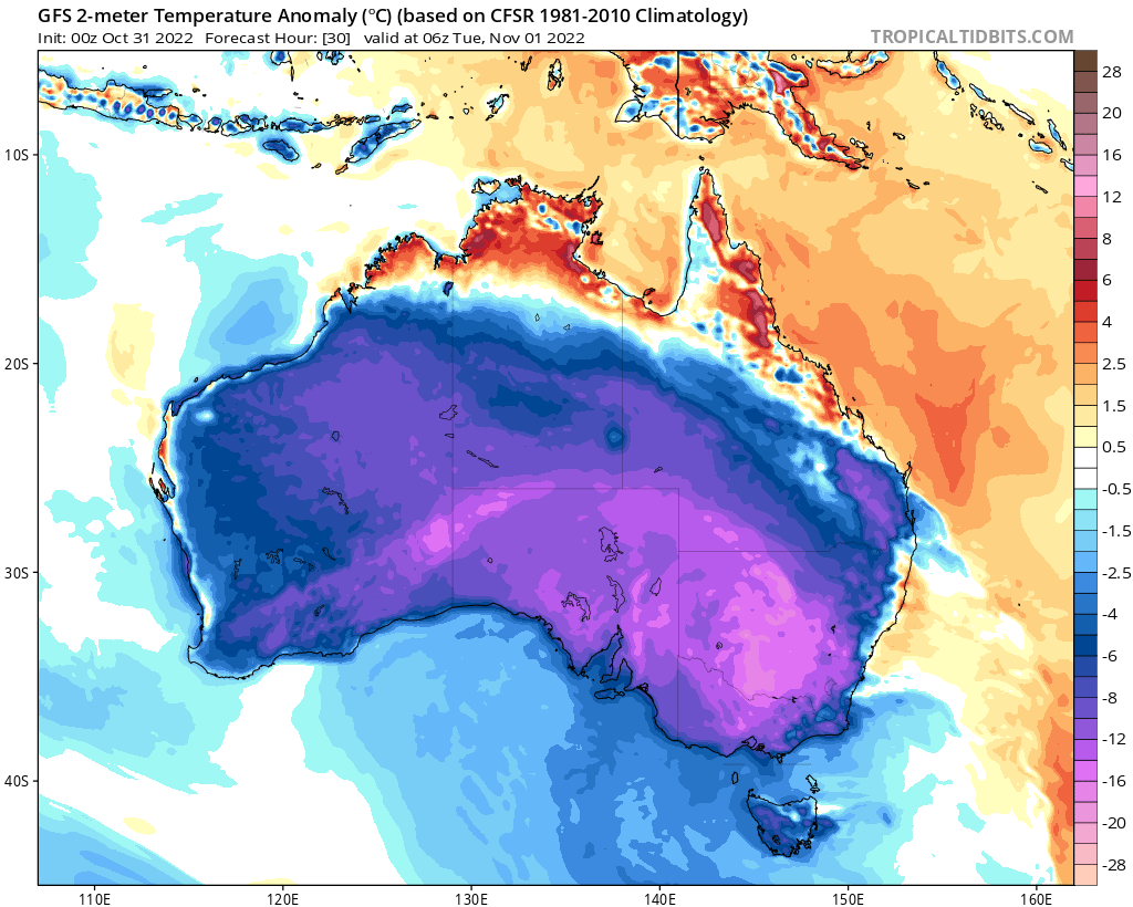
Weatherzone said temperatures of 10C-15C below normal.
Widespread showers are possible with hail and thunder, strong and gusty winds and snow falling to as low as 600m in Tasmania, 700m in Victoria and 800m in NSW by Tuesday night and Wednesday morning.
Snow is also possible around the NSW Central Tablelands, and the Northern Tablelands.
READ MORE: China slams reported plan for US B-52 bombers in Australia
Snow flurries above 900m are also possible for the Flinders Ranges in South Australia on Tuesday morning.
Drivers are warned to be careful on the road under icy, snowy conditions.
Major flood warnings are current in parts of NSW, Victoria, and Queensland, with renewed flooding expected from upcoming rainfall.
Meanwhile, as the south-east shivers, much of the country's north is facing ongoing heatwave conditions, with temperatures forecast to be 2C-6C above average in the high 30C to low 40C range.
The heat in the Top End and northern Queensland will combine with heavy humidity, bringing rain and some relief from the heat, but high to extreme fire danger ratings will remain in place for the NT, South Australia, western Queensland and parts of Western Australia.
Source: https://ift.tt/JLa5NoX
Comments
Post a Comment