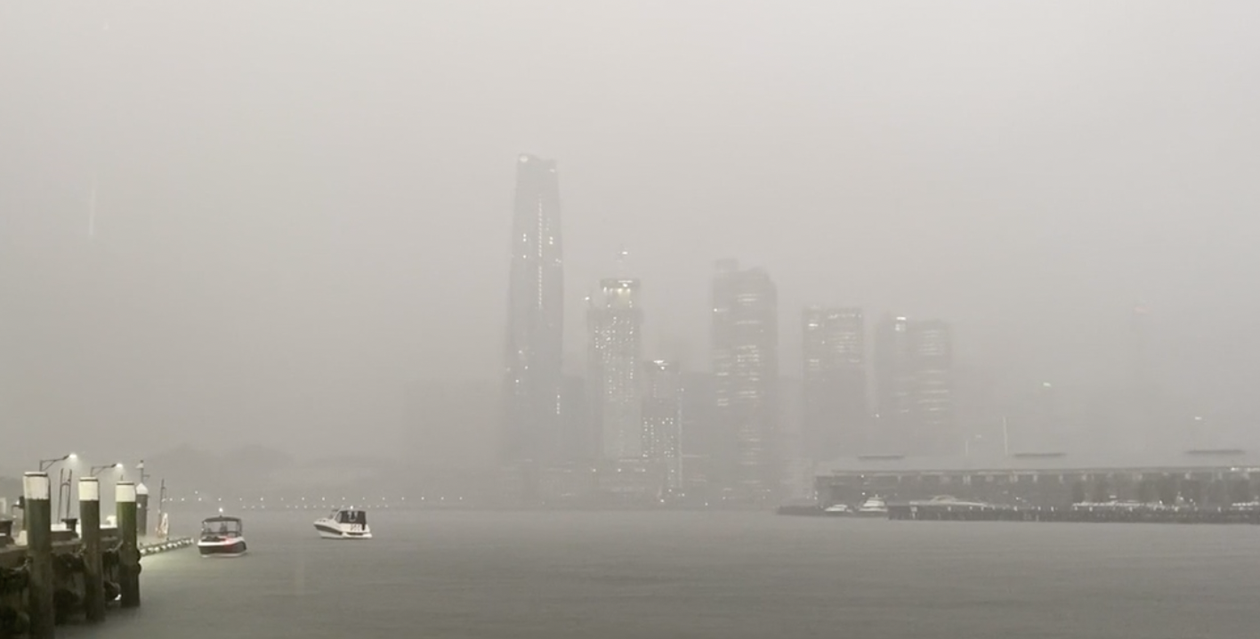
Heavy rain felt across Sydney over the past two days will ease today, however a potential thunderstorm is expected to hamper ongoing clean-up efforts.
The torrential downpour that has soaked Sydney has smashed records.
The New South Wales capital has officially seen its wettest summer in 30 years.
READ MORE: Russian forces 'ready as they can be' for Ukraine invasion
Weatherzone said more than 120mm of rain has fallen during the last two days.
"This soggy 30-hour period has brought Sydney's running summer total up to 518.4mm, making this now the city's wettest summer since 1991/92," they wrote.
Northern NSW is now in the firing line of heavy rain, as a slow-moving trough sweeps across south-east Queensland into the state.
A number of flood warnings are in place, with the Tweed, Brunswick, Wilsons, Richmond, Orara, Bellinger and Nambucca Rivers posing the most risk.
READ MORE: Queensland facing more rain, as search for missing man continues
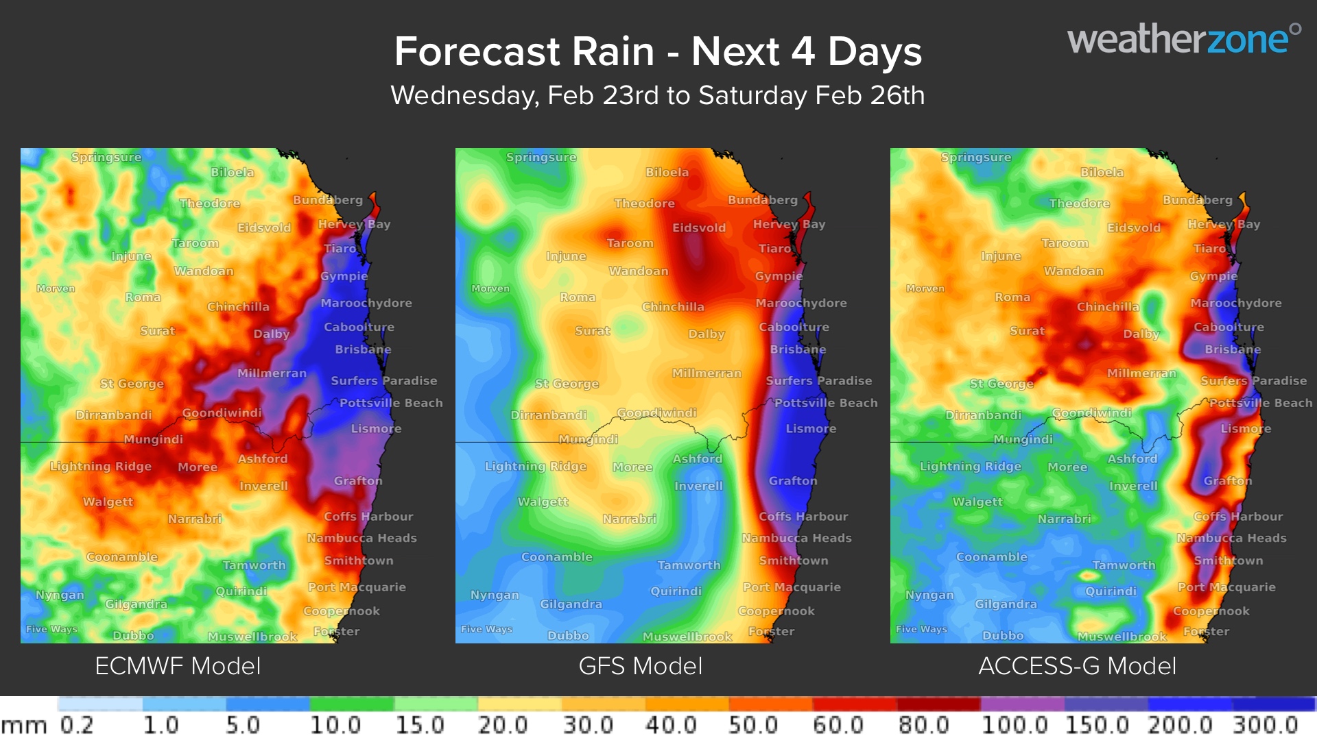
A severe weather warning has been issued for people in Northern Rivers and parts of Mid North Coast and Northern Tablelands Forecast Districts.
"Heavy rainfall which may lead to flash flooding is forecast over areas northeast of Tenterfield, Dorrigo and Bellingen through today (Thursday) and likely to continue on Friday," the Bureau of Meteorology (BoM) said.
"Six-hourly rainfall totals between 70 to 100 mm are likely, increasing to 100 to 160 mm over areas east of about Kyogle and Grafton.
"Locations which may be affected include Tweed Heads, Lismore, Grafton, Coffs Harbour, Tenterfield, and Dorrigo."
READ MORE: Ukrainian government websites go down in 'mass DDoS attack'
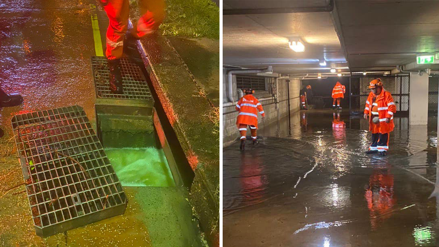
Clean-up continues
NSW State Emergency Services (SES) are responding to callouts across the state, as leaking rooves, flash-flooding and downed trees threaten residents.
And of midday yesterday, the SES had received 1230 total requests for assistance.
They have performed 22 flood rescues.
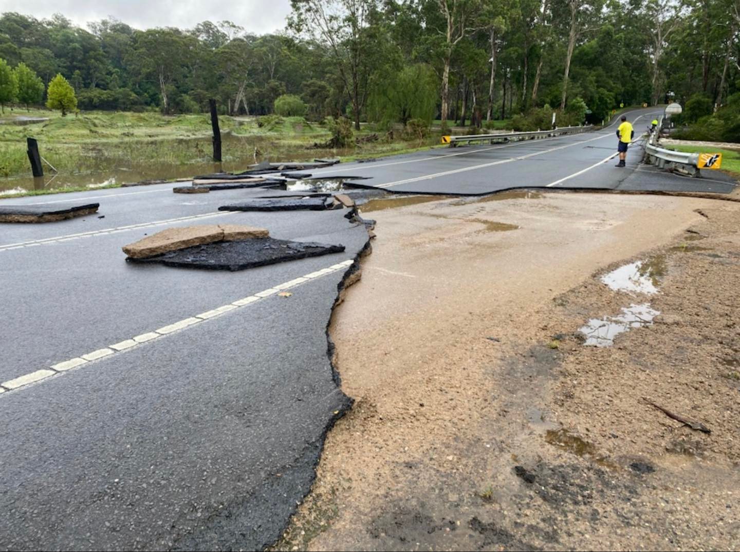
The sheer amount of water has caused portions of road to completely away in some parts of Sydney.
Cattai Ridge Road at Maralya is repaired and open after a large portion of the road was swept away.
Read on, to see what the weather is doing across the nation's capitals.
Brisbane
Brisbane is bracing for a wet day, with heavy rain and storms forecast.
The mercury will reach a maximum of 23C today.
Sydney
A maximum temperature of 26C will be felt in Sydney, which will be hit with showers.
There's also a chance of a thunderstorm, with possible heavy falls during the morning and afternoon.
Melbourne
It will be a humid and cloudy day in Melbourne, with a top of 24C.
The BoM said there's a medium chance of showers, most likely during the morning and early afternoon.
There's also a chance of thunderstorm during the afternoon, most likely over outer northern and northeastern suburbs.
Canberra
Canberra also has a wet day in store with the BoM forecasting a high chance of showers, most likely during this afternoon and evening.
There's also the chance of a thunderstorm.
A maximum temperature of 26C will be felt.
Hobart
A maximum temperature if 22C will be experienced in Hobart.
It will be cloudy, with a medium chance of showers most likely later tonight.
Adelaide
It will be 31C and mostly sunny in Adelaide.
Winds will tend south to southeasterly at 25 to 35 km/h reaching 35 to 45 km/h about the foothills and southern suburbs this evening.
Darwin
There's a high chance of showers, most likely from the late morning, in Darwin.
The BoM has also forecast the chance of a thunderstorm, with gusty winds in the afternoon and evening.
Winds will tend north to northeasterly at 25 to 35 km/h.
The mercury is expected to reach 31C.
Perth
It will be a hot, sunny and windy 37C degree day in Perth.
Winds will tend east to southeasterly at 25 to 40 km/h and then tend south to southwesterly 20 to 30 km/h near the coast in the afternoon.
Gusts to 80 km/h possible about the hills and foothills in the morning.
Source: https://ift.tt/Sa86RNj
Comments
Post a Comment