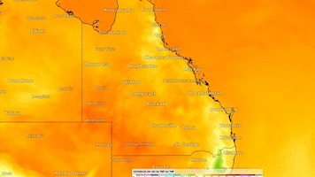
Queenslanders are set to swelter through a heatwave this week, with parts of the state predicted to hit 40C.
Humidity levels will soar in Cairns and Darwin and are projected to hit upwards of 50 per cent in the south-east.
Weatherzone said the "oppressive" heat is the result of "an extremely hot and humid airmass" which has begun to spill into southeastern Queensland.
Brisbane residents should brace for several uncomfortable days and nights, particularly on Wednesday, the service warned.
READ MORE: Father and son die after being swept off rocks at Sydney beach
"The next few days and nights are going to feel oppressive in Brisbane," Weatherzone wrote.
"A combination of extreme heat and high relative humidity are going to make temperatures feel around 5 to 10C above average, even for the peak of summer."
In the state's south east the combination of high heat and humidity could make temperatures feel close to or above 35C between 9am and 4pm on Wednesday, and possibly up to 38 to 40C in the early afternoon, Weatherzone added.
Speaking from the Scenic Rim, Today weather presenter Tim Davies said the humidity was already driving up temperatures.
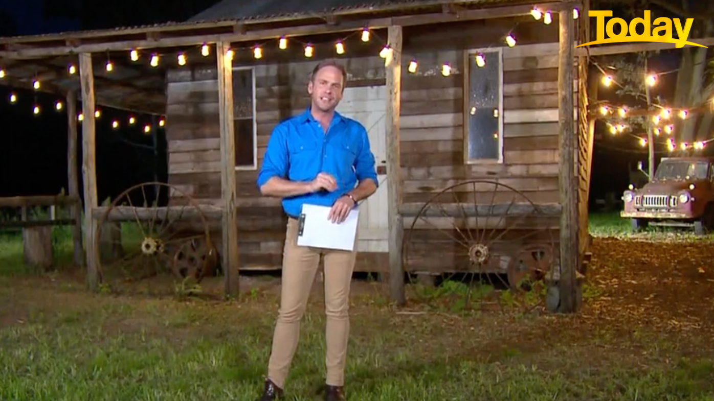
"The humidity here is intense, adding around 4 to 5C," he said.
"It's sort of humidity you would expect to feel if you were in Cairns or Townsville."
Temperatures are expected to drop by almost half in parts of Queensland on Thursday when an "unusual" cold front sweeps into the Sunshine State.
The front will drive temperatures down around much of the nation.
Sydney's longest summer dry spell
The heatwave comes after Weatherzone revealed Sydneysiders are enjoying their longest dry spell of the summer.
"The current seven-day rainless streak is by far the longest stretch of dry weather to date in Australia's largest city.
"As of 9 am on the morning of January 31, it was seven days without rain recorded at Observatory Hill."
The previous longest dry spell was five days from December 31 to January 4.
Australia is currently in the grips of La Niña, which is characterised by wet weather.
More heavy rain for WA and SA
Western Australia and South Australia has been smashed with multiple days of heavy rain as part of the north's wet season.
READ MORE: Outback towns in SA's north remain cut off
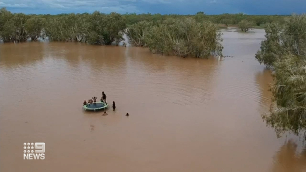
A "one-in-20 to 50-year" rain event has hit Broome in Western Australia.
The town has recorded 360mm of rain in the past 36 hours, a four-year high and more than in all of 2021.
The heavy rain has led to widespread flooding with parts of the tourist hotspot currently underwater.
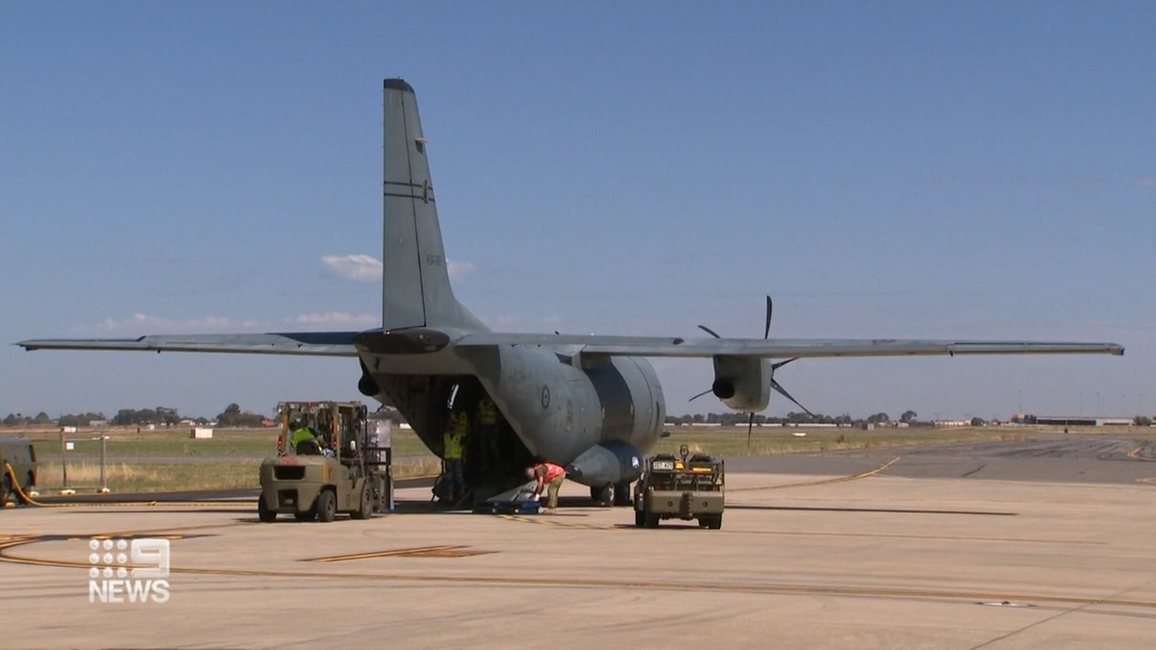
Across the border the RAAF had to fly in supplies to Coober Pedy, a remote outback town in northern South Australia, which has also been cut off by flood waters.
More heavy rain is expected across Western Australia and South Australia today.
The Bureau of Meteorology (BoM) has issued a severe weather warning for people in parts of Kimberley, Pilbara and North Interior district.
A tropical low is expected to bring squalls, destructive winds and intense rainfall.
https://twitter.com/BOM_WA/status/1488156912273305600?ref_src=twsrc%5Egoogle%7Ctwcamp%5Eserp%7Ctwgr%5EtweetA severe weather warning is also in effect for South Australia, with people in the North East Pastoral and parts of North West Pastoral districts told to be on alert.
There, severe thunderstorms and heavy to intense rainfall is forecast.
Now let's take a look at what the weather is doing across the nation's capitals today.
Brisbane
The mercury will reach 35C today in Brisbane, which has a humid and hot day ahead.
The BoM said there's also a chance of a shower in the afternoon and evening.
Sydney
Sydney's dry spell could be coming to an end with the BoM warning showers are developing after a mostly sunny morning.
The temperature will reach a maximum of 31C.
Melbourne
Temperatures will reach a high of 24C in Melbourne, where conditions are cloudy and humid.
There's a medium chance of showers, most likely in the afternoon.
The BoM warned a possible thunderstorm could hit the eastern hills in the early afternoon.
Canberra
A shower and possible storm could play out in the nation's capital today, where temperatures will climb to 30C.
The BoM has forecast a medium chance of showers, most likely this evening, and the chance of a thunderstorm late this afternoon and evening.
It could possibly be severe with heavy falls.
Hobart
A humid and wet day is ahead for Hobart, which has a medium chance of showers, most likely late morning and in the evening.
Temperatures will climb to 26C.
Adelaide
The mercury will reach 24C in Adelaide today, which will be partly cloudy.
There's a medium chance of showers about the northern suburbs, and a slight chance elsewhere. A thunderstorm is also possible early this morning.
Winds will tend southerly at 30 to 45 km/h.
Darwin
Darwin has a partly cloudy day ahead, with temperatures tipped to reach 31C.
Showers are highly likely and there's a chance of a thunderstorm, possibly severe with damaging winds.
Perth
Perth will experience the country's coldest morning, at 15C, before the temperature climbs to 32.
It will be clear and mostly sunny with winds tending southeasterly at 25 to 35 km/h before increasing to 25 to 40 km/h in the late evening.
Source: https://ift.tt/QNOiaIjo7
Comments
Post a Comment